Name of Site: Harappa
Location: Harappa
Date of occupation: 3500 BC-1500 BC
The historic site of Harappa is in Sahiwal district on the old bed of the Ravi River which runs to the north of the site. The river has since shifted six miles further north. The site was first visited by British railway engineers to get bricks for Lahore- Multan railway line. However, famous archaeologist Alexander Cunningham visited the site in 1853 and 1856, and did small excavation in 1872, which then identifies the site with that of Malii, which Alexander had ordered to be blockaded when he invaded the subcontinent. During his excavations, Cunningham found pottery, chert blades, and a seal. Despite several excavations, Cunningham found very little to preserve as the majority of the settlement had been stripped of bricks. Harappa lies on the periphery of the known Indus Valley Civilization, served as gateway cities into the main region where that civilization held sway and were hence more robust or powerful than smaller cities. It is spread over 450,000 sqm of space.

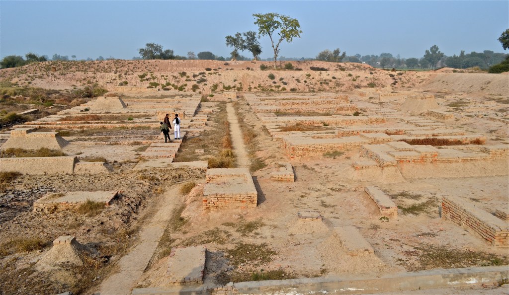
Ransacked by local housebuilders and mostly demolished during the 19th century CE construction of the Lahore Multan railway during the British Raj, the ruins at Harappa now stand in a fragile state but nonetheless still have a host of information to provide us. Harappa shares some common features with Mohenjo-Daro. The circuit of both cities’ spreads to about 3 miles, and both the cities are divided into upper and lower cities. The upper city is roughly in the shape parallelogram that was 400-500 yards north-south and 200-300 yards east-west. The height is 40 feet from the flood-plain. The city was planned on north-south axis.
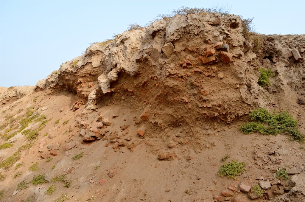
Massive defensive walls on all sides have been partially exposed. A tapered embankment to protect against floods was made along the outer defensive wall as well. This was formed by filling up the previous alluvial deposits that had been washed away by rains with more mud bricks and mud. Bastions are seen at regular intervals as well with the main entrance seen at the north end. There is also an entrance to the west end next to a bastion. The Citadel area has 6m high mud brick platform.

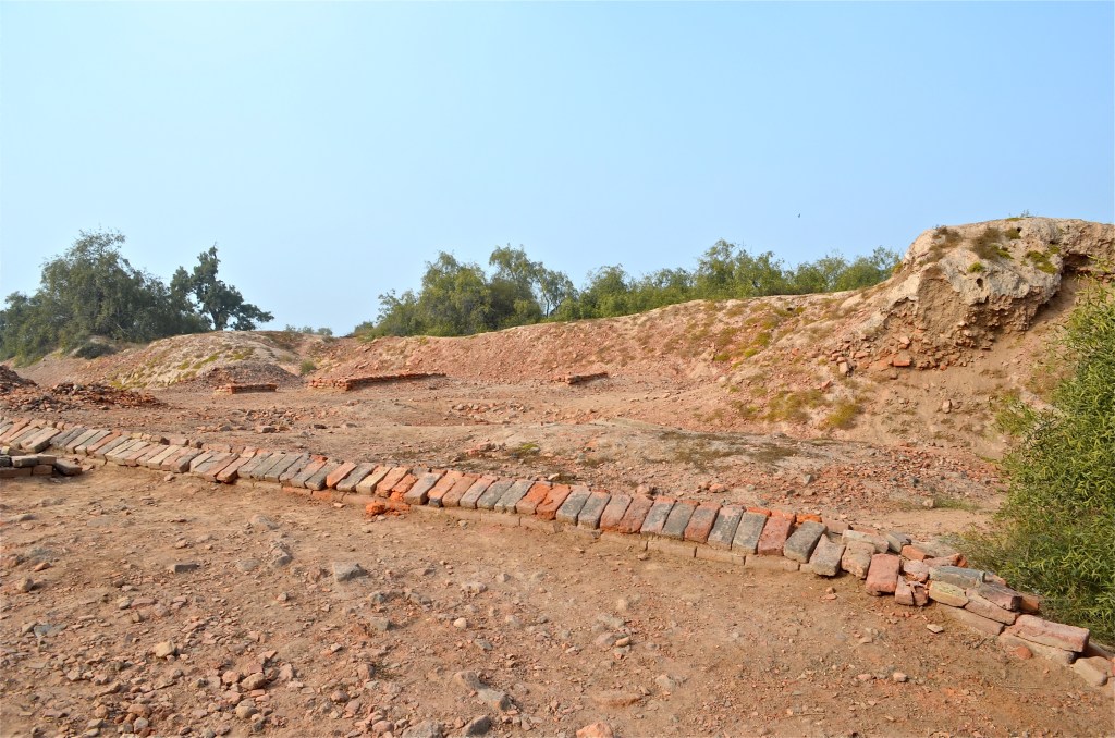
The city was excavated in different phases. Mound E is the oldest section of area which also has a pre-Harappan settlement underneath. It has a mud brick perimeter wall facing in places with baked bricks. The south wall has a major gateway in the center of a large curve that extends out into the plain seemingly encompassing a public space on the outside. A large open area inside the gateway was probably a staging area for checking or taxing of goods or a public market for out-of-town traders. A large street to the east of the gateway leads north to the center of the city where evidence of workshops of agate, shell, and copper works are found.
Thirty meters due south of the main mound gateway is a small mound of the Harappan period with houses, drains, bathing areas, and a possible well, which probably served as an externally placed traveler’s stop for incoming caravans. Only the walls around mound AB have been properly excavated and these were 14 meters wide at the base and larger and higher than the ones of Mound E. Working platforms and craft debris is also found. This mound is also enclosed in the same manner as Mound ET. These Mounds, although belonging to varying periods, still formed part of the same overall culture.
The most prominent feature of the Harappa is the drainage system. Smaller drains from household latrines and bathing areas connected to these larger drains, which had corbelled roofs so they could be buried underneath the main streets when required without caving in.
Varying types of houses and buildings are found in both large and small settlements. Houses range from 1-2 stories in height, with a central courtyard around which the rooms are arranged. Fourteen workmen quarter with bent entrances have been found. The interior is not visible from the street, shut off using corridors or walls in the inside. Openings are also restricted to side streets to maintain privacy on the inside of the houses.
Large public buildings are the third major category and include both public spaces such as markets, squares and courtyards, and administrative buildings including granaries. A large granary has been identified in Mound F, lying on a massive mud brick foundation with a rectangular plan of 50m x 40m, with the length corresponding to the North-South axis. The foundations point to a total of 12 rooms in two rows (6 rooms per row) divided by a central passageway that is 7m wide and partially paved with baked bricks. Each room measures approx. 15m x 6m and has three walls at the long ends with air between them pointing to hollow floors. The main structure would probably have been of wood built on these foundations with stairs leading up from the central path. There have also been found triangular openings in the floor which might have been air ducts to remove moisture from the inside.